The Topography Drive: Pacific Rim
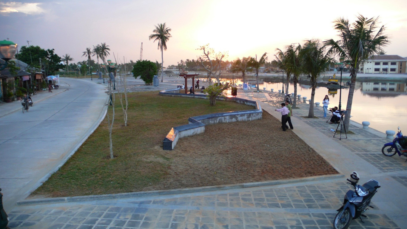
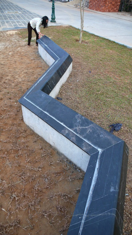
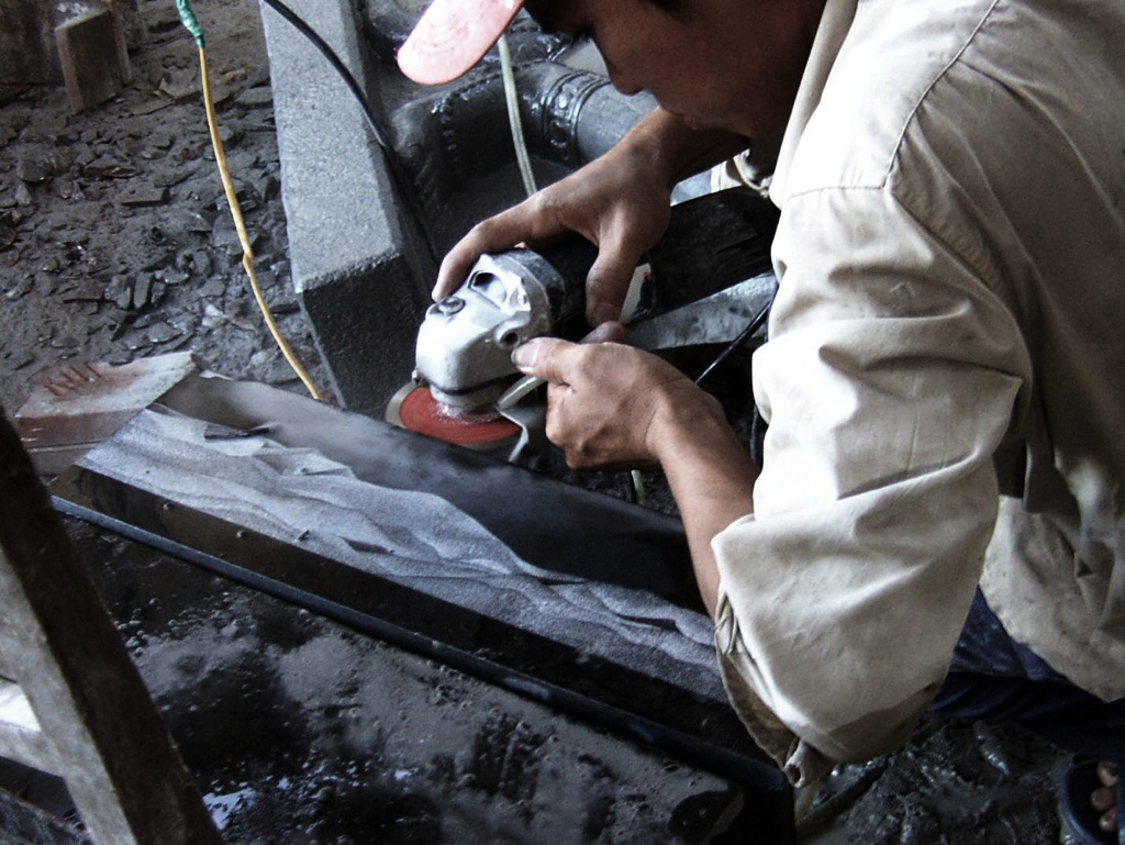
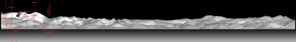
The Topography Drive: Pacific Rim series renders the entire Pacific Rim at the scale of 1 : 1,700,000 using digital elevation model data (DEM). An iteration of the work as a 160 yard long, 4 inch high image was shown at the Yokohama Triennial in 2005. A very different version featuring moving projectors, a moving landscape, and a high definition rendering of the flyby was shown at the Tokyo National University for Fine Arts in 2006. The most recent piece depicts the Vietnamese coastline from the same International Dateline viewpoint. Etched in black marble, the work is a 120-foot-long permanent public sculpture in the coastal town of Hoi An in central Vietnam. It "captures" the entire Vietnamese coastline at 1 : 50,000 scale.
Topography Drive: Pacific Rim engages conceptual themes of distance, scale, time, and experience. Topography Drive puts the audience in the imaginary driver's seat, and the route of exploration is as geographically real as it is a conceptual mediation. The trip begins smack in the middle of the Pacific Ocean, just south of the Aleutian Islands. We are traveling southward along the International Dateline. Looking westward, you see the night-lit topography of Japan emerge from the ocean; looking eastward, you see the topography of the West Coast of the US lit by the sun's rays. In essence, you see day and night landscapes together in an exploratory scene that both flattens the earth and eliminates atmospheric effects - a view of our world that is dream-like but underscored by very real data points. The artwork is, in fact, based on what one really would see if one could flatten space, eliminate natural atmospheric distortions, and see across planetary-scale distance.


Hoi An Horizon (Hoi An, Quang Nam Province, Vietnam 2007)